“What Puerto Rico Trench?” Exactly.
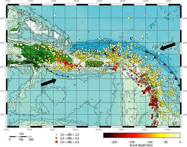
The arrows in the map below show the direction the underlying Caribbean tectonic plates are moving, with the resultant build-up of pressure releasing into a myrid ofearthquakes in the region over the years. Puerto Rico is the smaller green island in the middle, with the Dominican Republic the larger island to the left. The string of other Caribbean islands is buried under the earthquake markers that flow down the page to the lower right.
You can see the Puerto Rico Trench wraps around the entire zone.

No comments:
Post a Comment